
By Charlotte VAN HEK, Communications Officer at the UITP
GNSS, EGNOS, Galileo… You might have seen these acronyms when reading about urban mobility, but do you really know what they mean? And how they can benefit urban mobility? This article tries to explain the basics of satellite technologies and answer the most frequent questions about satellite navigation technologies applied to mobility and public transport.
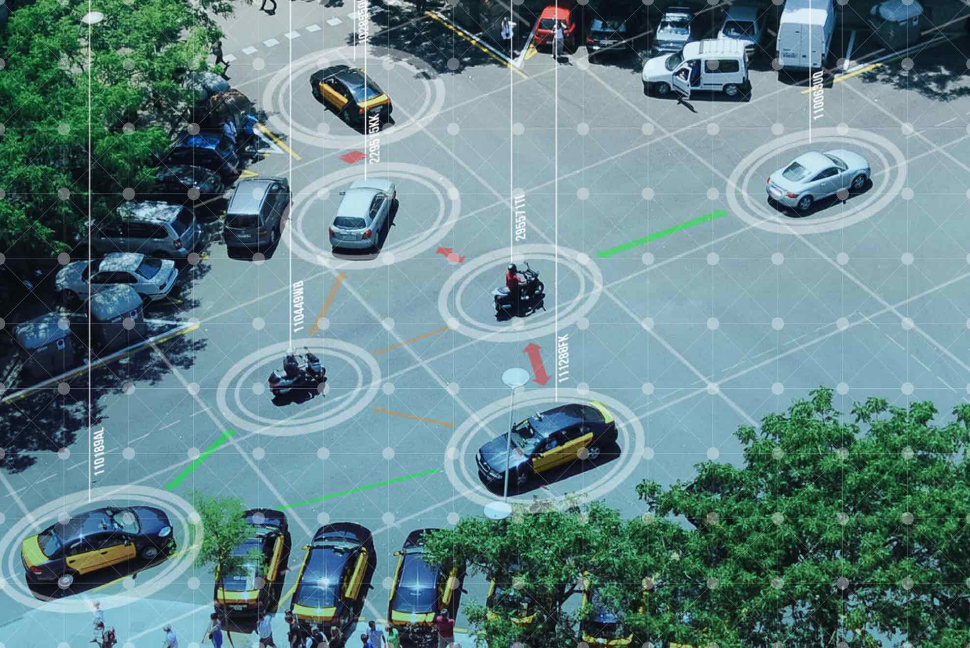
Many satellites currently orbit around Planet Earth, with one of their functions being to help you figure out your exact location. Now, knowing where you are is always handy, but specifically when you are moving around a city. When travelling and using different means of transport, knowing your position and that of the vehicle you are going to use, is essential.
GNSS – Global Navigation Satellite System
There is more than one type of satellite providing positioning and navigation services. Global navigation satellite system (GNSS) is the general term describing any satellite constellation providing signals from space that transmit positioning and timing data to GNSS receivers. The receivers then use this data to determine location.
Some examples of GNSS are the USA’s Global Positioning System (GPS), Russia’s Global’naya Navigatsionnaya Sputnikovaya Sistema (GLONASS) and China’s BeiDou Navigation Satellite System.
Europe has its own satellite constellation, called Galileo.
Galileo provides improved positioning and timing information with significant positive implications for many European services and users. The system has been operational since December 2016, and can be used in combination with GPS satellites (or any other constellation).
What are the distinctive features of Galileo?
Multipath errors are still one of the major error sources for conventional GNSS receivers. A multipath error is caused by the reception of signals arrived not only directly from satellites, but also reflected from the local objects in the environment. Basically, a multipath error will cause your location to be less accurately determined.
One of the main benefits of Galileo is that when compared to other GNSS, Galileo has a higher resiliency against multipath, meaning it will determine location more accurately. Recent tests made with Galileo-enabled devices achieved 1-2 metres accuracy in light urban environments and a few decimetres at full open sky (in which case it is easier to determine location).
Accuracy, integrity and continuity of the signal in a complex urban environment is key to fully deploy the potential of the evolving urban mobility landscape, with innovations such as Mobility as a Service (MaaS) and shared mobility services becoming more and more popular.
Furthermore, Galileo greatly contributes to the robustness of GNSS in terms of safety and security.
Over the last decade, our ever increasing dependency on GNSS has raised concerns over the security of navigation services against intentional threats such as spoofing (disguising a communication from an unknown source as being from a trusted source).
Satellite signal failure could have severe implications on, e.g. public transport, shared mobility services, truck and taxi drivers, and emergency services. To tackle these concerns, Galileo has started Open Signal Navigation Message Authentication (OSNMA) service signal-in-space transmission in the first quarter of 2020 and will have full service available in 2021, in other words providing an authenticated signal, which is currently not provided by any other GNSS system. This service will allow to assess the trustworthiness of any signal. With the addition of Galileo to the global GNSS constellation, risks of signal failure are significantly reduced.
EGNOS
The European Geostationary Navigation Overlay Service (EGNOS) is Europe’s regional satellite-based augmentation system (SBAS) that is used to improve the performance of GNSS systems such as Galileo and GPS. It has been deployed to provide safety of life navigation services to aviation, maritime and land-based users over most of Europe. EGNOS is operational since October 2009.
So, simply put, EGNOS enhances even further the accuracy of GPS-determined areas, and will do so shortly with Galileo, as well. Trials with EGNOS have demonstrated that it provides an increase in the position accuracy (error reduced on average of 3 meters), both in urban and extra-urban environments.
EGNOS is essential for applications where accuracy and integrity are critical, for example, in the aviation sector. But it also benefits numerous other market segments, for example applications related to on-road fleet management and in the near future to the deployment of connected and automated driving.
For more information on GNSS, Galileo and EGNOS, check out the European Global Navigation Satellite Systems Agency (GSA)’s website or Join the ARIADNA Newsletter.
This article is based on GSA’s paper ‘RECOMMENDATION OF THE EUROPEAN GNSS AGENCY (GSA) ON THE BENEFITS OF EGNOS AND GALILEO RECEIVERS FOR PUBLIC TRANSPORT’, published in December 2018